GALLERY: Maps (lots more to come:)

In 1604 Samuel de Champlain anchored off Stratton Island. Map Key: The figures indicate fathoms of water_.
A . The river. B . Place where they have their fortress. C . Cabins in the open fields, near which they cultivate the land and plant Indian com. D . Extensive tract of land which is sandy, but covered with grass. E . Another place where they have their dwellings all together after they have planted their com. F . Marshes with good pasturage. G . Spring of fresh water. H . A large point of land all cleared up except some fruit trees and wild vines. I . Little island at the entrance of the river. L . Another islet. _M_. Two islands under shelter of which vessels can anchor with good bottom. N . A point of land cleared up where Marchin came to us. O . Four islands. P . Little brook dry at low tide. _Q_. Shoals along the coast. R . Roadsted where vessels can anchor while waiting., for the tide.
1604 Saco Bay - Samuel de Champlain Voyage (Prouts on Right)
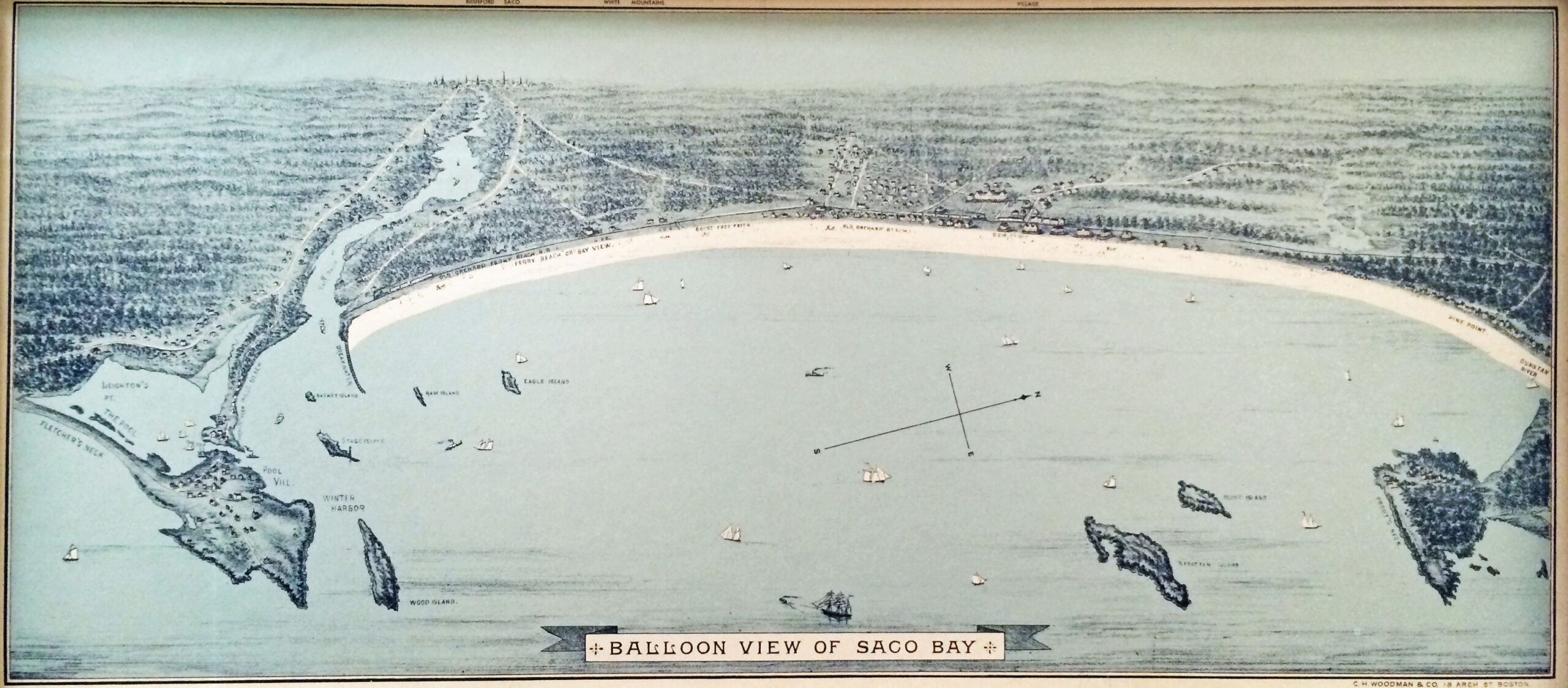
We hope to find a better copy of this someday. Some nice detail on Prouts, Biddeford and Old Orchard.
1880 Balloon View of Saco Bay - From Book - Old Orchard Beach & Saco Bay, by J.S.Locke
