Development of a Summer Colony
The Great Divide: From Libby’s Neck to Prouts Neck
by Caroline Willauer, August 2014
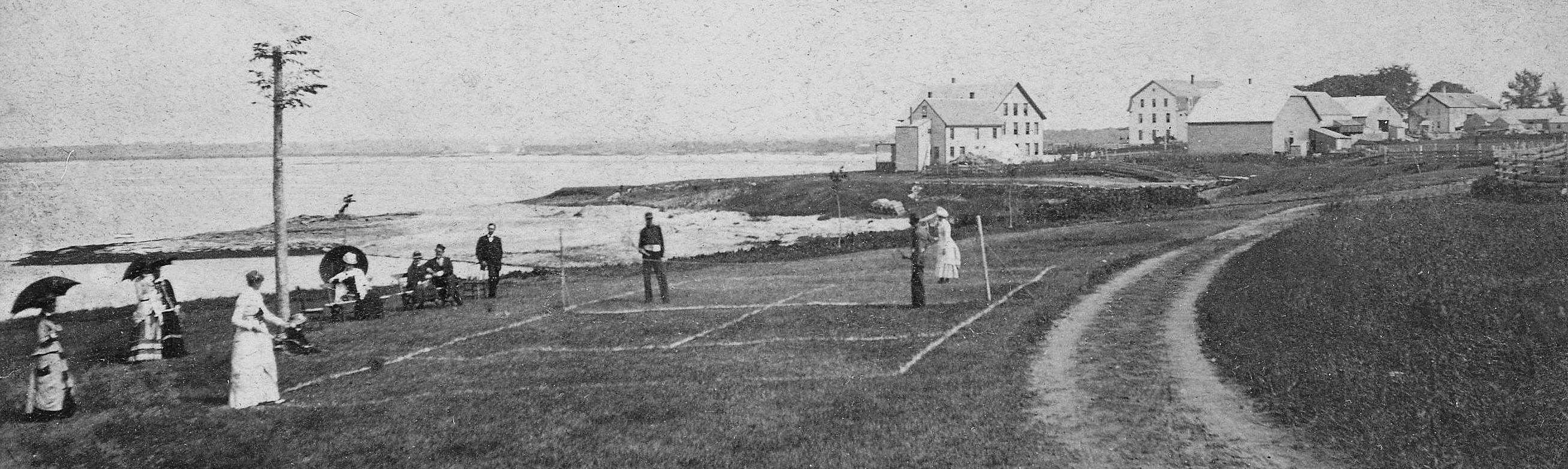
In 1871, Capt. Thomas Libby died at the old Libby farm on Prouts Neck, then called Libby’s Neck, leaving the western tract of the Neck to his three children, Silas, Benaiah, and Minerva. The Libby family subdivided Prouts Neck in 1878 and soon hotels and boarding houses were built along the shores. Within a few years the Homer family purchased a significant portion of the land on Prouts Neck, including a home on the southern tip, with the intention to develop it into a popular summer destination.
Property in the central part (the meadow part) was bought by the Merrick family and much of the woods and of the land along the shore became the property of the Homers. “The Sanctuary” and the woods around it were owned by Charles and Winslow Homer.
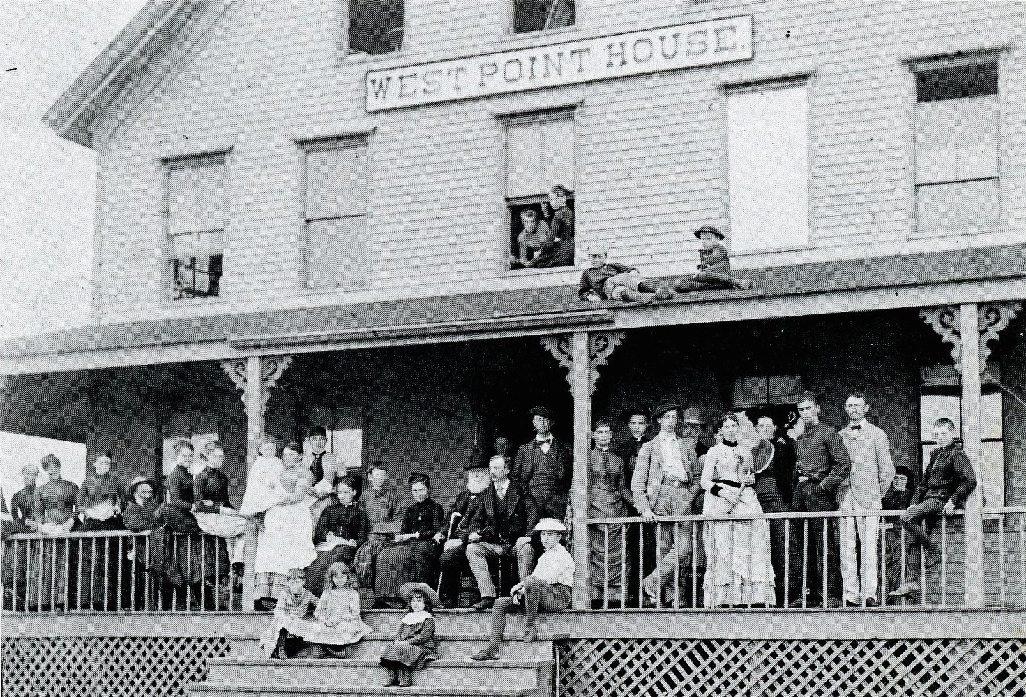
Guests at the West Point House circa 1890.
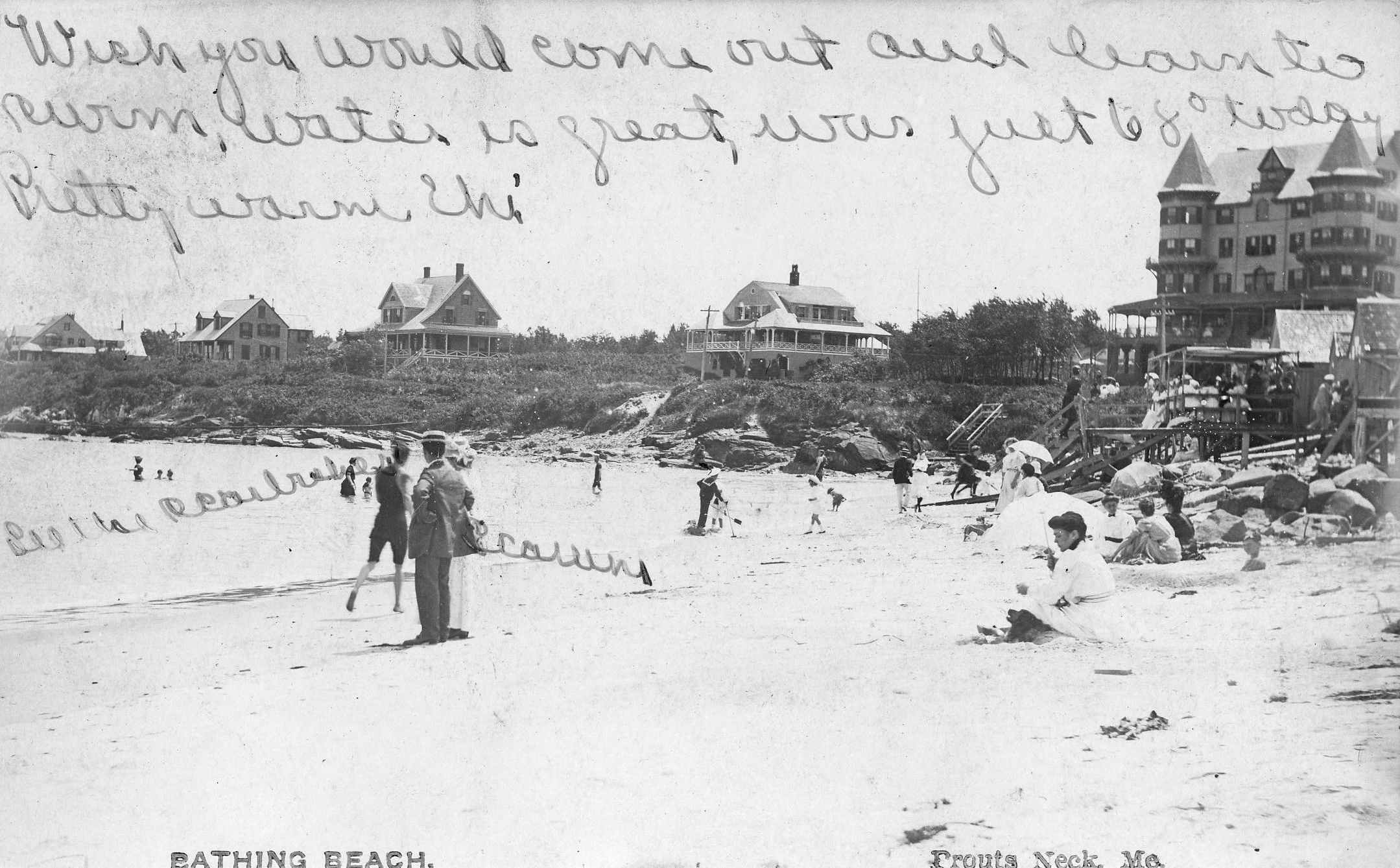
Postcard from 1902 showing the Jocelyn Hotel and bathing beach.
Cottages Designed by John Calvin Stevens
The Homer family built several houses in the area that were designed by John Calvin Stevens as speculative property. Many of the Homers’ former homes remain today, including a home owned by Winslow Homer called Kettle Cove, which Homer paid for with a painting. Homer did not live in the home, preferring to remain at his cottage and rented it out most of the time.
From Kenyon C. Bolton III’s essay “The Right Place: Winslow Homer and the Development of Prouts Neck,” from Weatherbeaten: Winslow Homer and Maine. New Haven: Yale University Press, 2012.
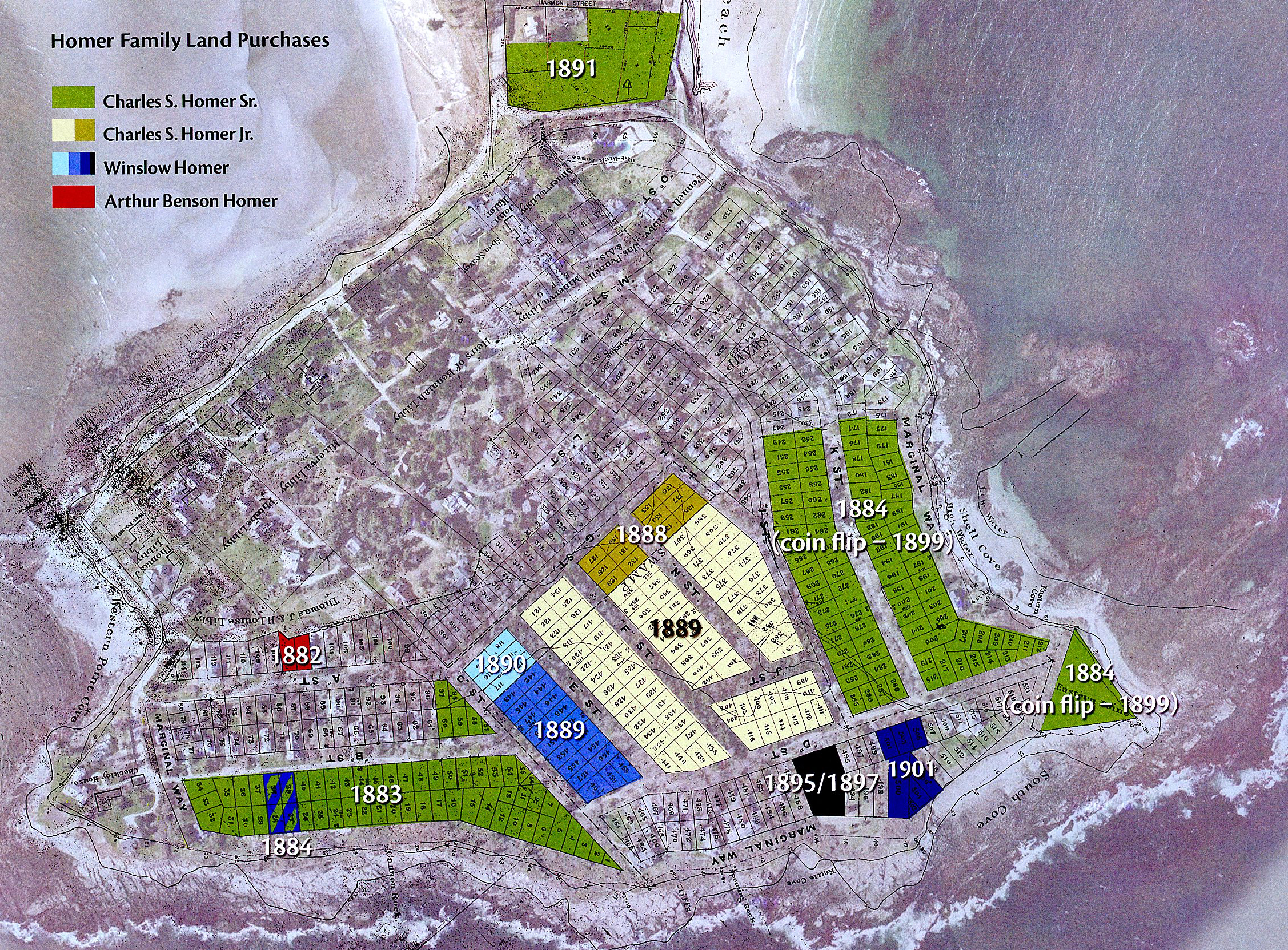
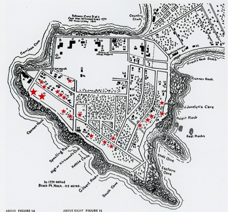
1882-1901 HOMER FAMILY LAND MAP
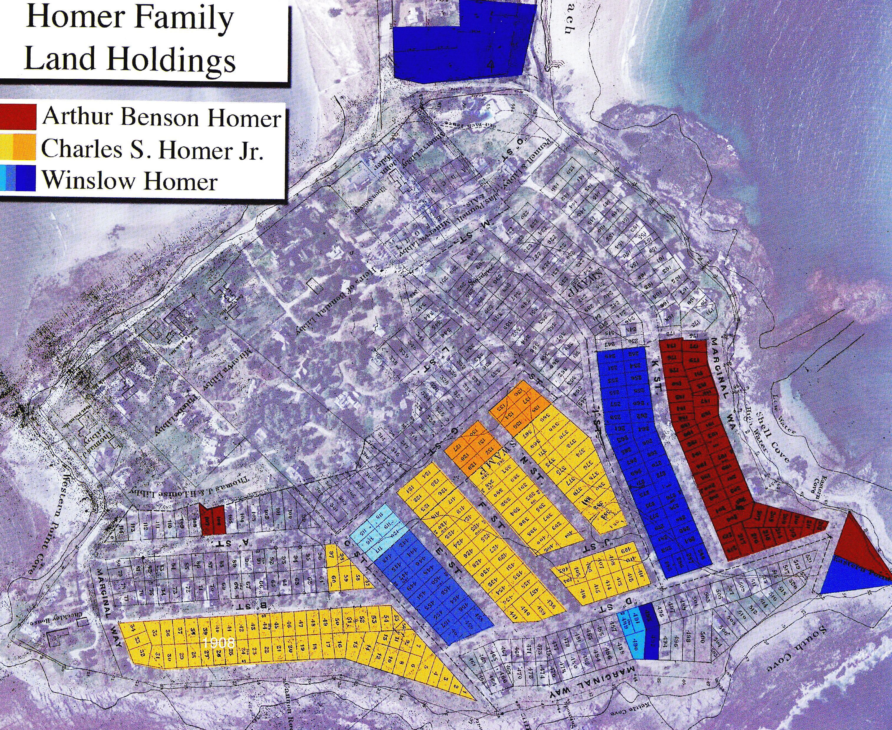
1908 HOMER FAMILY LAND MAP


Oh yeah, there’s a LOT more to say about THIS topic 🙂